Road Tripping Through the West, Part Three

As our road trip through Colorado continued, brilliant fall colors were already on display on the very first day of fall. After leaving Great Sand Sand Dunes National Park and Preserve, we drove the entire length of the Silver Thread Scenic Byway on our way to Black Canyon of the Gunnison National Park. The Byway wound along the banks of the Rio Grande River, tracing the routes of old stagecoach lines and railways of the late 1800s. Named after a time when silver mining and ranching were the main industries in a land that was still part of the Wild West, the Silver Thread passes through beautiful mountains that are swallowing up the remains of old ghost towns and mines.

fall colors along the Silver Thread Scenic Byway

We stopped in the rain to look out at the Weminuche Wilderness of Colorado, where the Rio Grande River originates in the heart of the San Juan Mountains at 13,821 ft elevation. This overlook was too pretty to pass by!

fall colors in the Weminuche Wilderness

When we reached the Gunnison River, which has been dammed to create Blue Mesa Reservior in the Curecanti National Recreation Area, we stopped to admire the Dillon Pinnacles across the river.

Dillon Pinnacles by the Blue Mesa Reservior in the Curecanti National Recreation Area

A short distance later, we arrived at Black Canyon of the Gunnison National Park – known for being “deep, steep and narrow.” It has been carved over the course of 2 million years by the Gunnison River, which used to flow with a force as much as 2.75 million horsepower, rushing through the canyon at 12,000 cubic feet during its flood stage. Today dams upstream make the process of erosion happen more slowly.

Black Canyon of the Gunnison

The park lands below the canyon rim are also designated wilderness, with no maintained or marked trails leading down to the inner canyon. Poison ivy is also abundant along the way down, so I opted to do a series of shorter hikes near the rim during this visit. Maybe if I make it back again I will try dropping 1,800 vertical feet in one mile down to the river while hanging on chains and scrambling over boulders, and then climbing back out again. Or not. 🙂

Our next planned destination was Mesa Verde. While driving along Highway 145 on the way there, we passed by Telluride and decided that it was too beautiful a place not to stop and explore. Telluride is surrounded by the highest concentration of 13,000 and 14,000 foot peaks in North America – how could we not take a little detour to check it out?

Telluride

We spent the night in a pretty little campground in the Uncompahgre National Forest, surrounded by aspens with leaves in brilliant shades of yellow and orange.

Uncompahgre National Forest campground

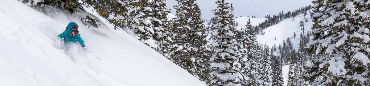
The next day we rode the tram and hiked the See Forever Trail up above 12,000 ft elevation, both to take in the beautiful vistas all around, and to check out how amazing it would be to come back in the winter and ski Telluride!

view from the tram at Telluride in autumn
the view from the See Forever Trail at Telluride in autumn
The view from the See Forever Trail at Telluride
Telluride ski resort in autumn

Then we were back on the road again, headed for Morefield Campground in Mesa Verde. After a restful night at camp (and a hot shower! what a treat!), we spent the day exploring the fascinating ruins of Mesa Verde. The Ancestral Pueblo people (Anasazi) lived in Mesa Verde from 550 AD until the late 13th century. Many of the dwellings in the park are located below natural overhanging cliffs, and are very sophisticated in their construction and design.

Balcony House
The view from inside Balcony House, a cliff dwelling that requires a steep climb up a ladder to enter. The round chambers are called kivas. Kivas are still included as central places within the community in m any modern pueblos.
Balcony House
Stones used for grinding corn inside Balcony House
Spruce Tree House
Spruce Tree House, the third largest and best preserved cliff dwelling in Mesa Verde. Circa 1200-1280 AD.
Spruce Tree House
Another view inside the Spruce Tree House
Square Tower House
Square Tower House
Cliff Palace
Cliff Palace, Mesa Verde. Sadly, it was closed to exploration inside the dwellings for the season.

After a full day of exploring Mesa Verde, we spent a second night at Morefield Campground, and then set out for Canyons of the Ancients National Monument. Our first stop was at the Anasazi Heritage Center, which serves as the Canyons of the Ancients headquarters, to pick up maps and visitor information and to visit the museum inside. We then set out into the remote and rugged desert to explore Painted Hand Pueblo. The road to the trailhead was rough and rutted, making us glad to be driving it in a high-clearance truck. It was a hot, dry early autumn day as we took the short hike to the pueblo – such very different weather from the freezing cold and howling wind that nearly blew me off my feet in Rocky Mountain National Park just a week earlier.

Painted Hand Pueblo
Painted Hand Pueblo, Canyon of the Ancients, Colorado

Painted Hand Pueblo is in the middle of the Great Sage Plain, where deep soils hold winter moisture and have been used for dryland farming for hundreds of years. Painted Hand Pubelo was built in the 13th century, and was originally a small village of about 20 rooms. Some remaining structures, like the one above, still include faint hand print paintings and petroglyphs.

“K’amagshe is ‘White Hands.’ He was a leader of Ship’app who led the people across the landscape and left white handprint marks. His hands were white. He leads the Follow the Leader Dance.” –Victor Sarracino, Water Clan, Pueblo of Laguna

Final stops: Hovenweep National Monument and Valley of the Gods in Utah, Monument Valley in Arizona, and Antelope Island State Park in Utah.

Road Tripping Through the West, Part Two: Great Sand Dunes National Park

After leaving the first stop on our road trip through Colorado, Arizona, and Utah – Rocky Mountain National Park – Max and I continued on to Great Sand Dunes National Park and Preserve. On the way there, we passed through the funky little historic town of Leadville, CO. At an elevation 10,152 ft, it is the highest incorporated city in the United States. Leadville was so scenic that we decided to stop there for lunch and for a quick walk around.

lunch on the outdoor patio at High Altitude Pies
Awaiting our lunch on the outdoor patio at High Altitude Pies. Despite being a clear and sunny day, it was a bit chilly at 10,152ft!
colorful historic buildings on the main street in Leadville, Colorado
Colorful historic buildings on the main street in Leadville, Colorado
Leadville, Colorado
Leadville, Colorado
Silver Dollar Saloon - Leadville, Colorado
The Silver Dollar Saloon, circa 1879 – dubbed “The Best Wild West Saloon in America” in a banner on the side of the building. I need to check out the inside next time!

After leaving Leadville (and deciding that we had to return sometime to explore the town and surrounding area some more), we were back on the road again heading south for Great Sand Dunes National Park and Preserve, where we would be camping at Piñon Flats Campground in the park for two nights. During our full day in the park, we hiked up to High Dune (699ft tall) and Star Dune (755ft tall) – twice! Both dunes are close to 9,000ft in elevation.

Great Sand Dunes National Park
hiking through Great Sand Dunes National Park
Great Sand Dunes National Park and Preserve

I had to really push myself the second time up. Unlike our cold and windy days in Rocky Mountain National Park, it was quite hot and dry here, with the sun reflecting off the sand. On the steep parts of the zig-zagging “trail” through the dunes, each step found me sliding a little bit back down as the soft sand gave way beneath each step. With my shoes loaded full of sand and feeling heavier and heavier, I had a few “I can’t do this any more!” moments. But Max encouraged me to climb up to Star Dune a second time for sunset, and convinced two other people along the way that they had to make it up too. This view with this light…. worth it!

Great Sand Dunes framed by the Sangre de Cristo Mountains

But the best thing to do in Great Sand Dunes is… play in the sand! We had fun laughing at each other’s awkward running jumps into the sand, which ended with a “dooooomph!” sound on impact. Max’s cannonball jump was the best! Next time we have to try the little-known sport of sandboarding.

playing in the sand at Great Sand Dunes National Park and Preserve
cannonball into the sand at Great Sand Dunes National Park and Preserve
Great Sand Dunes National Park and Preserve

Next stop: Black Canyon of the Gunnison.

Road Tripping Through the West, Part One: Rocky Mountain National Park

Last month, Max and I spent two weeks road tripping, camping, and hiking through Colorado, Arizona, and Utah. The first stop on our adventure was Rocky Mountain National Park. This was my second time being above 12,000 ft. elevation (the first time was while Backpacking the Wind River Range of Wyoming) and the first time I had spent an extended amount of time above 11,000 ft elevation.

We camped in Estes Park, sharing a campsite with a small herd of deer and a bunny who joined us in the evenings.

Camping in Estes Park, Colorado

We explored Trail Ridge Road, the historic Old Fall River Road, and Bear Lake Road in the park, doing many short hikes along the way. Strong gusts of bitterly cold wind battered us above the treeline, making me thankful that I had brought a winter hat, gloves, and a bandanna to cover my face!

Hiking in Rocky Mountain National Park, Colorado
Rocky Mountain National Park, Colorado
Mountain views in Rocky Mountain National Park, Colorado
The view from 12,000 ft elevation in Rocky Mountain National Park, Colorado
hiking up to 12,000 ft elevation in Rocky Mountain National Park, Colorado
Mountains with a dusting of snow in Rocky Mountain National Park, Colorado
Hiking in Rocky Mountain National Park, Colorado
Alpine tundra and mountains in Rocky Mountain National Park, Colorado
Mountains in Rocky Mountain National Park, Colorado
Bear Lake,  Rocky Mountain National Park, Colorado
Admiring the view in Rocky Mountain National Park, Colorado

We were surrounded by a vast silence with only the sound of the wind and the call of elk bugling in the distance as we took in the massive scale of our surroundings.

Bull elk in Rocky Mountain National Park, Colorado

The next day we woke up to a frost-covered tent and clear blue skies. We decided to take a hike up to Twin Sisters Peaks, a steep but popular hike up to 11,413 ft elevation on the eastern side of the park, surrounded by Roosevelt National Forest. Along the way up, we picked our way across the wreckage left by a huge mudslide that wiped out parts of the trail during the floods of 2013.

Just below the summit, we came across the sad scene of a man who had collapsed and died on the trail. His friend and some other hikers were performing CPR as a rescue helicopter circled, looking for a place to land. Sadly, it was too late to save him. We sat awkwardly bunched up for a while with a growing group of other hikers who had been behind us on the trail, wishing that there was some way that we could help.

Helicopter rescue on the Twin Sisters hike in Rocky Mountain National Park, Colorado

As more paramedics started to arrive, the man’s friend encouraged everyone to continue on. Feeling that it was best to get out of the way, we hiked the short remaining distance to the summit. From the summit we had panoramic views of the Estes Park valley and the Continental Divide, but it was a little bittersweet, and we didn’t stay long.

View from the summit of the Twin Sisters hike in Rocky Mountain National Park, Colorado

We had been considering staying a third day in Rocky Mountain National Park, but decided that this was a sign that it was time to hit the road again. The next day we set out for Great Sand Dunes National Park and Preserve.